
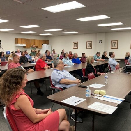

May 6, 2026 Public Meeting – Questions and Answers
As part of the public engagement process, attendees were invited to submit questions regarding the project. The project team has reviewed those questions and prepared the responses below. This information is intended to provide additional clarity and support continued transparency throughout project development.
- How much of the $6.8 million of funding secured for the Risk Mitigation System has been spent? How much has been spent on the engineer to date?
Over five years, the county has been under contract with Borton-Lawson (now Verdantas) to undertake engineering study efforts which has cost roughly $1 million to undertake.
The approximately $6.8 million is all funding that is unspent at this time and earmarked for the various projects moving forward. In addition, the County has applied, or is in the process of applying, for approximately $3.5 million in additional funding. If awarded, this funding would fully finance the three primary mitigation projects and support preliminary engineering for the levee system components. These efforts are being coordinated in partnership with SEDA-COG. - When will information be shared again publicly with the community on costs have been allocated to specific Mitigation projects and activities?
The County Commissioners will approve all projects’ contracts in their regularly scheduled public meetings. Another public informational meeting will be held in later 2026 to update the public concerning the projects’ development including cost updates. Information concerning another informational public meeting will be published once more tangible projects updates are available. Additional informational public meetings will continue to occur in the future. Ongoing questions concerning the projects’ can also be directed to bloomsburgfloodproject@seda-cog.org. - Are the hydrologists going to be the same company bidding on the project?
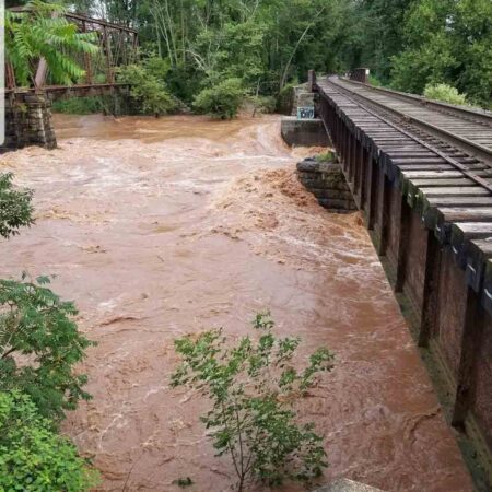
Since the May 6th public meeting, the county has retained the firm Verdantas to proceed with engineering efforts for the various projects. Verdantas has hydrologists on staff which participate in the previous study efforts and will be active as the projects proceed to permitting. - We know there is gravel that is being deposited on the bank to prevent sediment from accumulating in Fishing Creek. Does the sediment only come from one spot or does it come from other areas?
The existing islands in the creek are proposed to be removed. However, because the channel is so wide at this point, the island will simply return within 5 years unless the stream banks are narrowed to maintain channel velocity and sediment transport downstream. The sediment which comprises the islands originates from areas and tributaries all throughout the Fishing Creek watershed. - Can we have an independent review of the engineer’s information and preliminary studies/designs?
The previous study documents are all publicly available and can be viewed at the following links: - Will there be 3D modeling done? What kind of modeling will be done? (Something about incorporating and revisiting Bloomsburg studies…I’m not sure where and which ones these are).
The hydraulic modeling is completed in 2D. While 3D CFD (computational fluid dynamics) modeling is possible, that is usually used in very niche applications such as dam spillways, pumps, fluid mixing applications, etc. The Civil design elements are 3D compatible and can be rendered for visualization purposes if desired, but this usually requires some additional effort. - Has SEDA-COG ever administered a project of this magnitude and complexity?
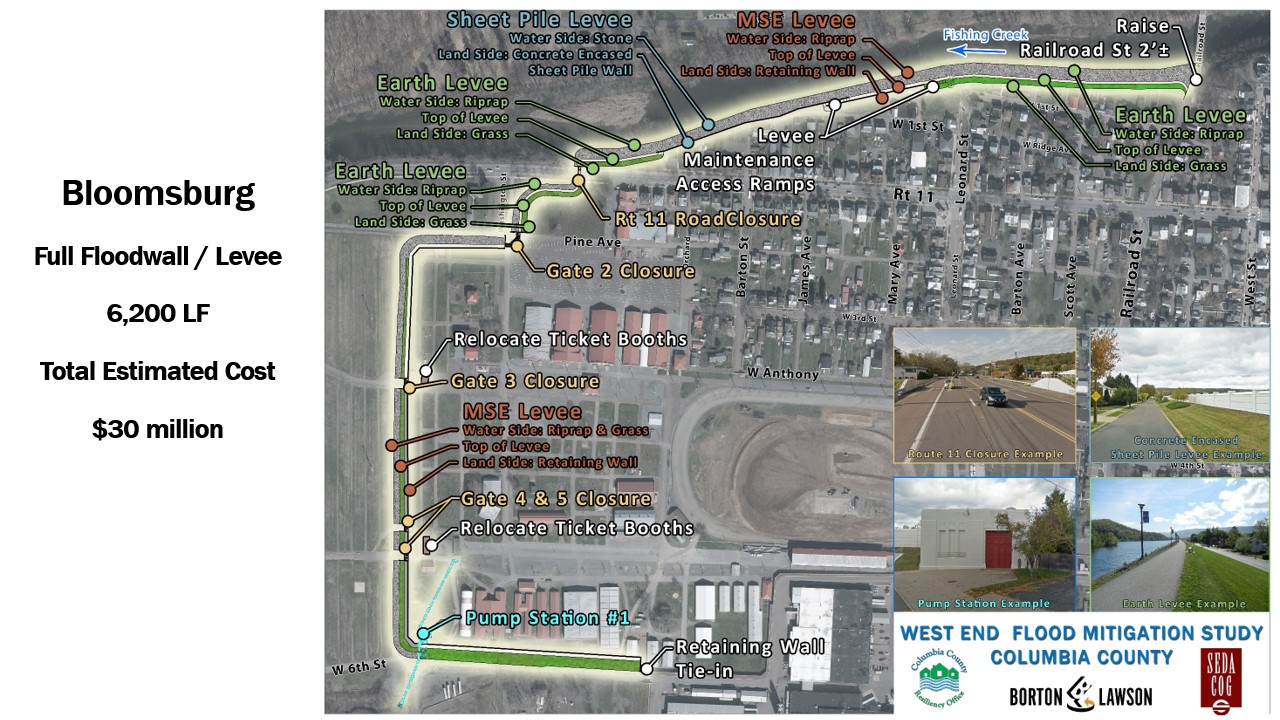
Yes. SEDA-COG has successfully overseen multiple large-scale flood mitigation projects comparable in scope and complexity.For example, SEDA-COG managed a flood risk management system in Bloomsburg that included approximately $30 million in combined public and private investment. This project provided protection for major employers such as Autoneum North America, Inc. and Windsor Foods, helping to safeguard approximately 800 jobs, and was completed in 2016.
Building on that effort, the Town of Bloomsburg—working in collaboration with the Bloomsburg Area School District—undertook an additional $17 million flood mitigation project. Completed in 2020, this project included a flood study and construction of a flood wall along West 12th Street, protecting key community assets including schools, residential properties, small businesses, and the town’s only fire department.
Together, these projects demonstrate SEDA-COG’s experience in managing complex, multi-phase flood mitigation efforts involving significant funding, multiple stakeholders, and critical infrastructure.
- Will Columbia County commissioners help the people of Fernville by including an emergency access road as part of this effort? Why is it not included in the current design?
The Fernville emergency access road is a separate project that is not part of the current West End Flood Mitigation and Risk Management System. Because it serves a specific local need within Hemlock Township, it needs to be advanced as an independent project led by the township.That said, the Columbia County Commissioners recognize the importance of improving access and safety for Fernville residents and are willing to collaborate with Hemlock Township in support of this project.
- What happened to Borton-Lawson and their engineering plans?Borton-Lawson was acquired by the firm, Verdantas. The study plans’ links are provided above.
- What are all the projects that need to take place before the levee is built? (Context: backup water from the storm systems that get backed up from fishing creek)
The sequencing of the mitigation projects are as follows before a levee system can be built with estimate construction dates:- US Route 11 Profile Adjustment (mid-2027)
- Bloomsburg Fairgrounds Swale Construction (mid-2027)
- Fishing Creek Channel Modifications (mid-2028)
- Is lowering route 11 going to make flooding worse on one side of the road? How will residents get in and out of the road?Lowering Route 11 by one foot does allow greater volumes of floodwater to spill into the fairground’s parking fields. Route 11 will be closed during a flood whether a) because Route 11 is flooded or b) because the closure structure across Route 11 has been closed. Residents would have egress to the east through town. The expected frequency of roadway flooding is not expected to be appreciably greater than present conditions.
- Is the creek going to get cleaned up in Fernville past route 80? The water doesn’t even flow at the beach anymore.
The project does not extend beyond the Railroad Street bridge. - Is there a wall being considered in Fernville?
The Columbia County West End Flood Mitigation Study Final Report concluded that “structural mitigation is not feasible for th(is) municipal(y) (Hemolock Township) since the low density of structures results in a low benefit to cost ratio. “ A Benefit-Cost Analysis (BCA) is a method used to evaluate a project by comparing its expected benefits to its costs, and it is commonly required in federal funding decisions to demonstrate that a project provides sufficient economic value to justify investment of public funds. The link to this study is previously provided. - Will lower creek levels eliminate the need to lower Route 11?
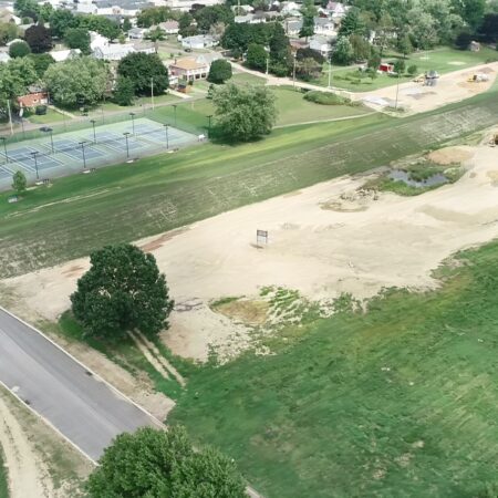
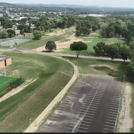
Lowering Route 11 is one of the primary mechanisms by which the creek levels are lowered back to current conditions. All mitigation features work in conjunction with one another to achieve this goal. - How are flood waters being directed and why are they being directed to the fairgrounds? Will this have more negative impacts to the already flood-prone fairgrounds and businesses located there?
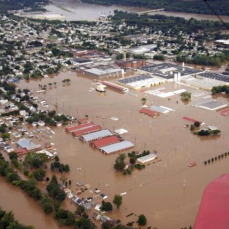
Flood waters naturally seek a path into the floodplain once levels exceed the banks. Modeling and damage assessments after Tropical Storm Lee showed high flow and high overtopping velocities in the 900 block of West Main St. The current concept aims to take advantage of this natural flow pattern and return floodwaters to the floodplain as quickly and as efficiently as possible to control flood levels on Fishing Creek. The open fields of the fairgrounds offers a convenient, undeveloped area of the floodplain for energy dissipation and storage of floodwater.Modeling showed minimal impacts to the Barn at Boones Dam property as a result of this concept as waters are significantly dispersed by the time they travel from Route 11, through the fields, and back to the creek. Because FEMA requires demonstration of zero increases in flooding at structures, a 6’ high berm is proposed on Fairgrounds property to shield the property from impacts resulting from the lowering of Route 11. With the berm in place, modeling shows no change to current flood depths or velocities due to the project.
- Suggestion for a question: What are the phases of this large Mitigation effort, and why is it so important to complete the initial Mitigation projects before the levee is built?
See above for sequencing of the mitigation projects. The following is provided from Addendum #2: 2-Dimensional Hydraulic Analysis Final Recommendations:“The Fishing Creek floodway is situated such that a proposed levee system would be constructed entirely within the regulatory floodway along the left descending bank of Fishing Creek, downstream of Railroad Street. Results of the 2D proposed conditions stream modeling performed in the Amendment No. 1 work indicated that the water surface elevation (WSEL) of the base flood increases by as much as 2.1 feet when a levee is constructed along the left bank of Fishing Creek without mitigation features. Without mitigation of the induced flooding, the residential areas in Hemlock Township adjacent to and upstream of the proposed levee would experience a greater risk of flooding because these areas would not be protected by the proposed levee. The recommended mitigation project will reduce the 2.1 feet of induced flooding predicted in the original West End Flood Mitigation Study to a zero increase for the base flood conditions, necessary for permitting of the levee systems.”
Project information, schedules, funding status, and technical details may evolve as engineering, permitting, environmental review, and funding activities progress. Responses are based on information available at the time of publication.